DFHRS - Tanzania
The DFHRS database of Tanzania was computed with the DFHRS software version 4.2 in the frame of the master thesis of Mrs. Dorothea Deus (2007): Determination of Transformation Parameters between the Tanzania National Levelling Datum and the Geoid. The master-thesis was funded as a DAAD-scholarship, and embedded in cooperation between the University of Dar es Salaam and the Karlsruhe University of Applied Sciences (HSKA).
Fig 1 shows the part of Tanzania, which was used as study area over Tanzania for the geoid computation within the above thesis.
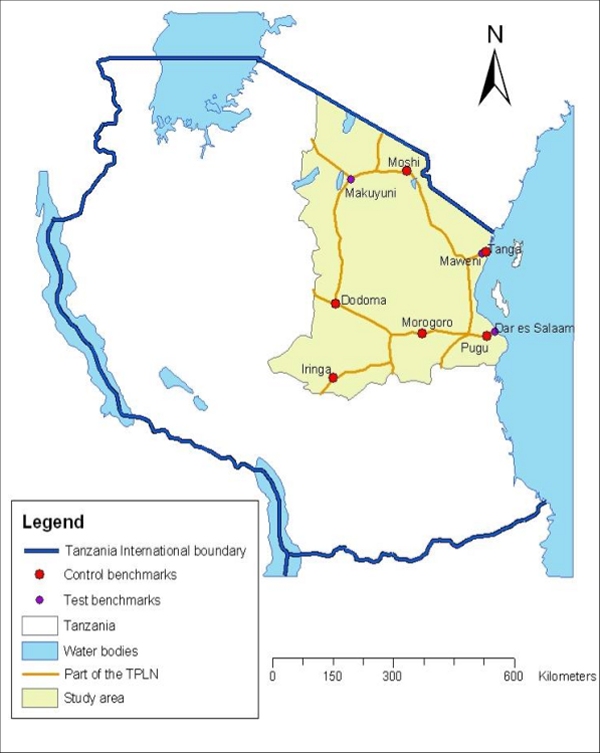
Fig. 1: Test area within Tanzania for the geoid computation using DFHRS software version 4.2
The geoid computation was based on EGM2006 and 10 identical GNSS-levelling points (B,L,h|H). The mesh-size was 30 km, and area was divided into 2 patches (fig. 2).
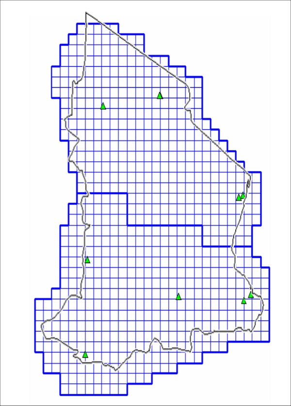
Fig. 2: Mesh- and patch-design and identical points (B,L,h|H) for the (5-10) cm DFHRS database computation (geoid) of Tanzania.
The analysis of the results proofed a (5-10) cm accuracy of the geoid for Tanzania in the test area. The isolines and a 3D-plot of the Tanzanian geoid are shown in fig. 3 and fig. 4.
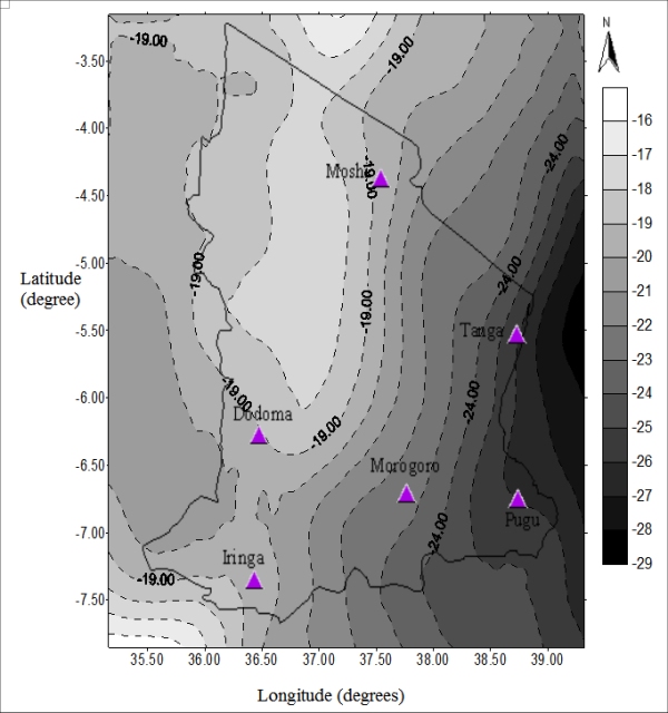
Fig. 3: Isolines of the DFHRS database for the geoid over Tanzania in the test area fig. 1.
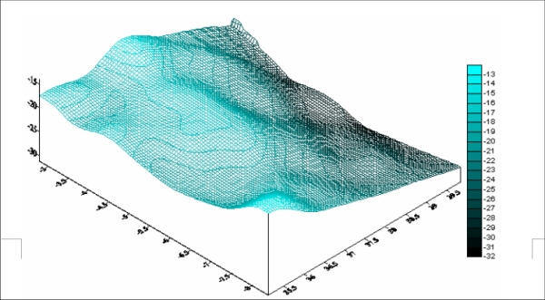
Fig. 4:: 3D plot of the continuous HRS polynomials N(p) based on EGM96 and ten identical points.
