Moldova QGeoid 2011
The computation of the GGeoid NQG for the Moldova was carried out in 2011 with the DFHRS-software version 4.2 in the frame of the BMBF-project Development of a High Capacity Real-Time GNSS Positioning Service for Moldova (MOLDPOS) between the Technical University of Moldova, the Agency for Land Relations and Cadastre (ALRC) of Moldova and IAF/HSKA (www.moldpos.eu). The MOLDPOS-project aimed at the development of HRS and datum-transformation parameter databases (fig. 1) as geodetic infrastructures for spatial information over Moldova following the European INSPIRE concept and for an active use by the GNSS positioning service MOLDOS (fig. 1).
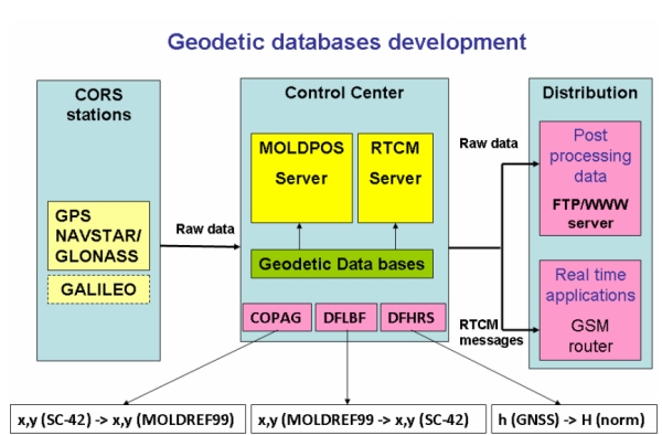
Fig.1: Technical concept for of the use of HRS- and datum-transformationparameter- databases as geodetic infrastructures the set up RTCM-transformation messages by GNSS positioning service MOLDPOS.
Fig. 2 shows the mesh and patch design and the fitting-points (B,L,h|H) use for the computation of the QGeoid for Moldova, which has an accuracy of 1-3 cm
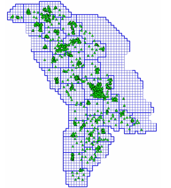
Fig. 2: Mesh and Patch design and Fitting-Points (B,L,h|H) for the Moldavian QGeoid computation using the DFHRS software version 4.2.
The DFHRS-databases for Moldova are used in all kind of GIS-based landmanagement and for setting up RTCM 3.1 plan- and height transformation messages for the GNSS positioning service MODLPOS. Fig. 3 shows the isoline plot of the computed QGeoid NQG for Moldova.
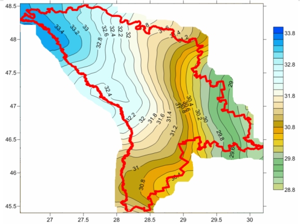
Fig. 3: Isolines of the Moldova QGeoid 2011 computed with the DFHRS software version 4.2.
