DFHRS Baltics and Baltic States 2004
The computation of the DFHRS-Databases for the Baltic area in total, and for the single Baltic
States (Estonia, Latvia and Lithuania) was part of the Master of Sience thesis of Mrs. Lauma
Lace (2004)Design, Computation, Statistical Analysis and Practical Quality Control of the
Digital Height Reference Surface (DFHRS for he Baltics, at the same time a cooperation of
the Latvian Agricultural University Jelgava and the Karlsruhe University of
Applied Sciences (HSKA).
The computation of the 4 DFHRS (1-3) cm databases were based on the DFHRS approach stage 1,
and each on a regular (10 km x 10 km) meshing, because former investigations showed, that a
polynomial-based HRS representation with polynomials of order 3 is enables in that way a HRS
resolution much better than 1 cm. In order to reduce the influence of long-waved systematic
errors, the quasi-geoid observations (see formula (2b)) were parted into 35 patches with
individual datum parameters (1 shift, 2 rotations), fig. 1a.
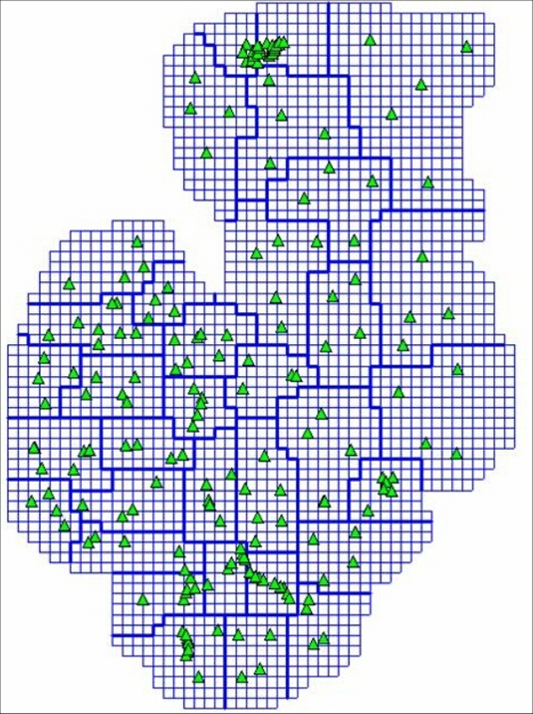
Fig. 1a: Mesh- and patch-design for the computation design of the (1-3) cm DFHRS database of the Baltics 2004 with the DFHRS software version 4
The DFHRS quality control was based on the network adjustment standards of gross error elimination in the identical points (B,L,h|H) by statistical tests (data-snooping) with simultaneous variance component estimation. The so-called accuracy surface, which is to be computed from the covariance matrix Cpp of the HRS parameters is shown in fig. 1b. The envisaged accuracy of less than 3 cm has been achieved in all 4 DFHRS projects. Fig. 1b shows the homogeneous accuracy surface and fig. 1c shows the isolines N(B,L,h) of the Baltic QGeoid 2004. It is intended to repeat all computations after the remeasurement of the 1st order levelling networks in the Baltic states.
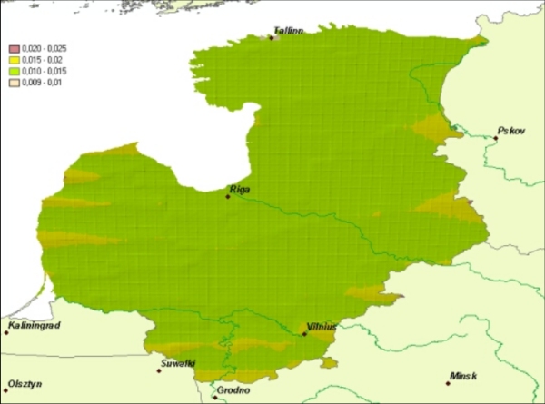
Fig. 1b: Accuracy surface of the computated quasi-geoid N(B,L,h) stored in the (1-3) cm DFHRS database Baltics 2004
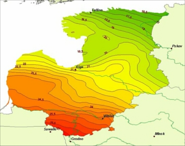
Fig. 1b: Accuracy surface of the computated quasi-geoid N(B,L,h) stored in the (1-3) cm DFHRS database Baltics 2004
Estonian DFHRS Database
Die DFHRS databases for the QGeoid of Estonia is based on a regular 10km x 10 km meshing. The area was partitionned into 5 patches (fig. 2a). The envisaged accuracy of < 3 cm could be proofed for Estonia in the frame of the DFHRS quality control. For the area of the capital Tallinn further identical points (B,L,h|H) could be used, which were provided by the DHRS project-leader as part of the data used for the education in the frame of the European Tempus Project of Geomatics Education in Estonia. For Tallinn already a regional high precise "0.5 cm DFHRS_DB Tallinn has been computed already in 2000.
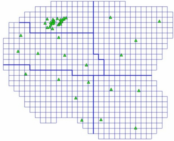
Fig. 2a: Mesh and patch design for the computation of the < 3cm DFHRS database Estonia 2004
The so-called accuracy surface for the QGeoid of Estonia, which is to be computed from the covariance matrix Cpp of the HRS parameters, is shown in fig. 2b. The envisaged accuracy of less than 3 cm has been over achieved. Fig. 2c shows the isolines of the Estonian QGeoid 2004.
Latvian DFHRS Database
The DFHRS database for the QGeoid of Latvia is based on a regular 10km x 10 km mesh design. The area was partitionned into 15 patches (fig. 3a) with individual datum parameters (1 shift, 2 rotations). The envisaged accuracy for Latvian QGeoid 2004 was proofed to be < 2.5 cm in the frame of the DFHRS quality control.
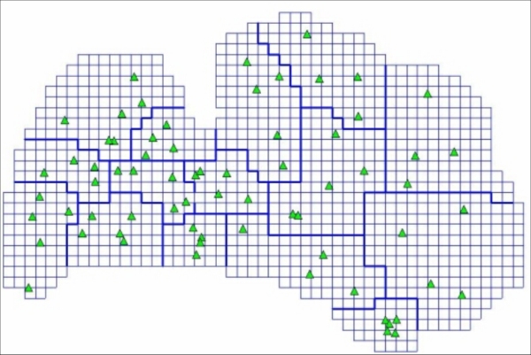
Fig. 3a: Mesh and patch design for the computation of the < 2.5cm DFHRS database Latvia 2004
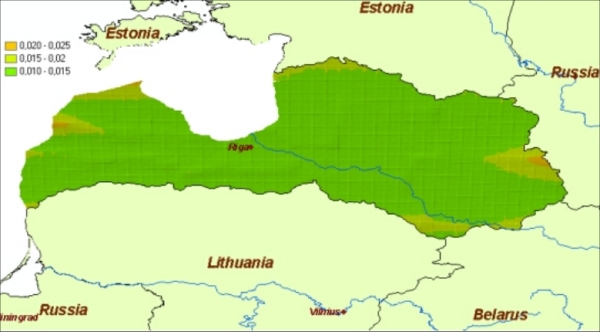
Fig. 3b: Accuracy surface of the < 2.5cm DFHRS database Latvia 2004
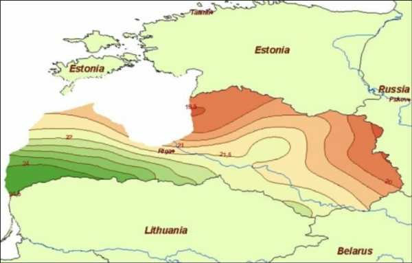
Fig. 3c: Isolines of the computed QGeoid N(B,L,h) of Latvia 2004
Lithuanian DFHRS Database
The DFHRS databases for the QGeoid of Latvia is based on a regular 10km x 10 km meshing. The area was partitionned into 19 patches (fig. 4a) with individual datum parameters. The envisaged accuracy for Latvian QGeoid 2004 was proofed to be < 2.0 cm in the frame of the DFHRS quality control due to the higher density of identical points in Lithuania, compared to the other Baltic states.
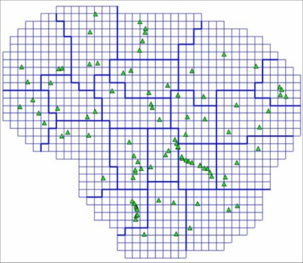
Fig. 4a: Mesh and patch design for the computation of the < 2 cm DFHRS database Lithuania 2004
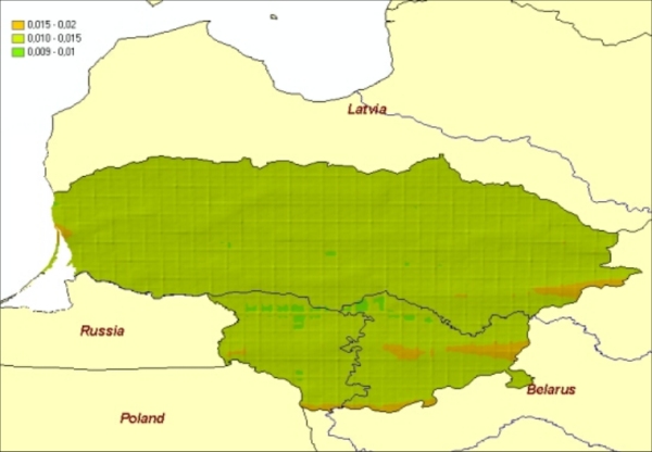
Fig. 4b: Accuracy surface of the < 2 cm DFHRS database Lithuania 2004
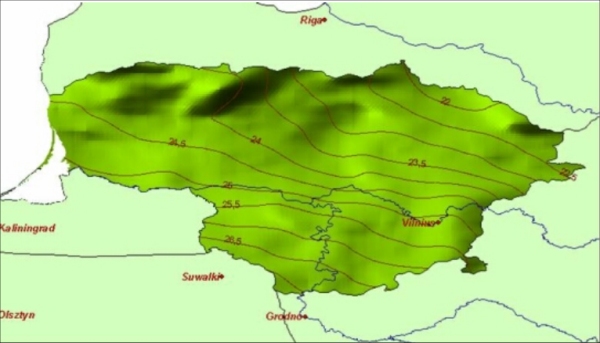
Fig. 4c: Isolines of the computed QGeoid N(B,L,h) of Lithuania 2004
