DFHRS - Hungary 2005
The DFHRS of Hungeria was computed in the frame of Master of Science thesis of Robert Gyenes (2005)
"Height Reference Surface Modelling and Computation" at the Faculty of Geomatics of the Karlsruhe
University of Applied Sciences
(Poster-Download (pdf)).
The data of identical points (B,L,h|H)) was made available by the
Institute of Geodesy, Cartography and Remote Sensing (FÖMI), Hungary.
The design of the (5 km x 5 km) meshes and the 115 geoid patches (max. 30 km of externsion) are shown
in fig. 1. The geoid and the vertical deflection observations were introduced according to the DFHRS
approach stage 1, formulas (2b) and (2c,d), respectively based on the EGG97.
The orthometric heights H and the ellipsoid heights h, respectively, were introduced with accuracies
of 9 mm and 7 mm, respectively.
The isolines of the computed (1-3) cm Geoid of Hungary are shown in fig. 2.
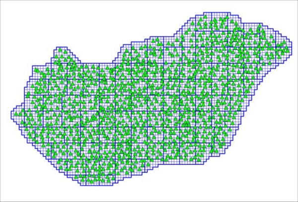
Fig. 1: Mesh and patch design togehter with the identical points of the (1-3) cm DFHRS Geoid of Hungary
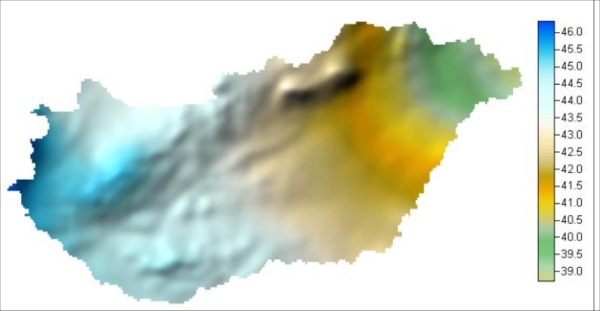
Fig. 2: Isolines N(B,L) of the DFRHS-based (1-3) cm Geoid of Hungary
