DFHRS - Bayern
The computation of the "1cm DFHRS-Database" for Bayern (Bavaria, Fig.1a/b) with the DFHRS-software version 4.0 was part of the diploma-thesis of Mr. Berthold Streifeneder (2003) Analyse des Leistungsspektrums und der Entwicklungstendenzen der europäischen GNSS- Dienste, Berechnung und Qualitätsanalyse einer hochgenauen Digitalen Finite Element Höhenbezugsfläche (DFHBF) für Bayern, sowie Softwareentwicklungen im Bereich Lage- und Höhen- Transformationsdatenbanken. At the same time it was and a cooperation project between the University of Federal Forces of Bavaria, the Barian state survey department (Landesvermessungsamt Bayern) and Karlsruhe University of Applied Sciences (HSKA). The identical points (B,L,h|H) were provided by the Bavarian state survey department Fig. 1 shows the 5km x 5 km FEM mesh design and the 25 patches, which were introduced to reduce the long waved deflection of the QGeoid model observations.
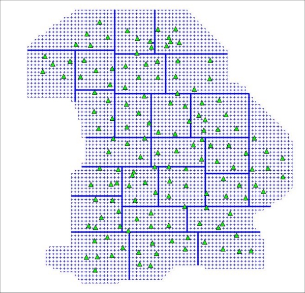
Fig. 1: Design of the 5 km x 5km meshes and the 25 patches together with the 145 identical points (B,L,h|H)
In variant 1 EGG97 QGeoid observations N were introduced, variant 2 observations 5 of the BKG QGeoid were used. The mean reproduction value (see quality control) of variant 1 and variant was 1.2 cm, and 1.1 cm, respectively. Fig. 2 also shows the difference between the HRS surfaces variant 1 and variant 2. In more than 90% over the area of Bavaria the difference is less than 1cm. The NN-heights version of the HRS of Bavarai was computed in 2003 in the above diploma thesis, and the Normal heights version in 2006.
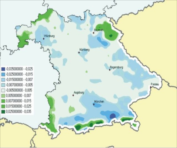
Fig. 2: Surface difference between HRS variant 1 (EGG97QGeoid observations) and variant 2 (BGK QGeoid observations). For more than 90 % of the difference is less than 1 cm.
Fig. 3 shows the isolines of the computed QGeoid N for Bavaria.
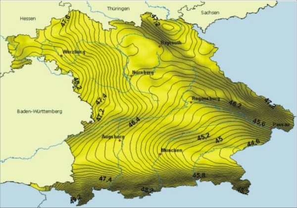
Fig. 3: Isolines of the computed QGeoid N for Bavaria.
