Baltic QGeoid 2012
The computation of the QGeoid for the Baltics (Estonia, Latvia, and Lithuania) was carried out with the DFHRS-software version 4.2. The result of a closed continuous QGeoid over the Baltics has an accuracy of 1-3 cm. A number of 213 identical points (B,L,h|H) were used (fig. 1). The levelled normal heights H were introduced with an accuracy of 5 mm, and the GNSS heights h with an accuracy of 7 mm. The QGeoid observations N and the vertical deflections have been taken from the EGG97 and introduced with an accuracy of 7 cm and 7", respectively. Alternatively the EGM2008 could have been introduced instead (see www.moldpos.eu) with the same accuracy in the area.
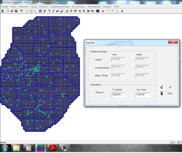
Fig.1: DFHRS-computation of the Baltic QGeoid. Screen-shot of the DFHRS-software 4.2, with the computation results showing the maximum and mean residuals for the N, H and h observations.
The DFHRS-database (224 KB) is ready for the use on GNSS-controllers and for setting up the RTCM height transformation message by GNSS positioning service providers in the Baltic area (www.moldpos.eu, www.geozilla.de). Fig. 2 shows the isoline plot of the computed Baltic QGeoid NQG.
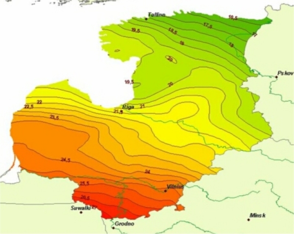
Fig. 2: Isolines of the Baltic QGeoid 2012 computed with the DFHRS software version 4.2.
