Brazil Geoid 2011
The computation of the Geoid N for the Brazil was carried out in 2011 with the DFHRS-software version 4.2 in a cooperation between IAF/HSKA and the Instituto Brasileiro de Geografia e Estatística (IBGE) Rio de Janeiro. The computations were done at he Geomatics Department of HSKA in the frame of the masterthesis of M.Güldenpfenning, titled Computation and Quality Assessment of Datum-Transformation and Geoid Databases as Basic Components of the Geodetic Infrastructure (GIPS) for the GNSS-Positioning Service of Brazil. Fig. 1 shows the mesh and patch design of the computation design. The result of a closed continuous QGeoid over Brasil has an accuracy of 3-10 cm.
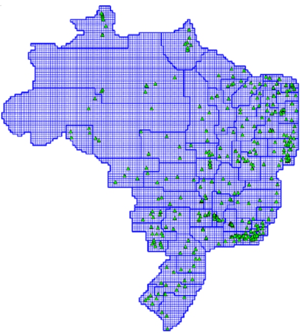
Fig.:1: Mesh and Patch Design DFHRS-computation of the Brazil Geoid N based on EGM2008 and Brazil fitting Points (B,L,h|H). Screen-shot of the DFHRS-software version 4.2.
The DFHRS-database Brazil is ready for the use on GNSS-controllers an for setting up the RTCM height transformation message for GNSS positioning service providers in Brazil (www.moldpos.eu, www.geozilla.de). Fig.2 shows the isoline plot of the computed Brazil Geoid N.
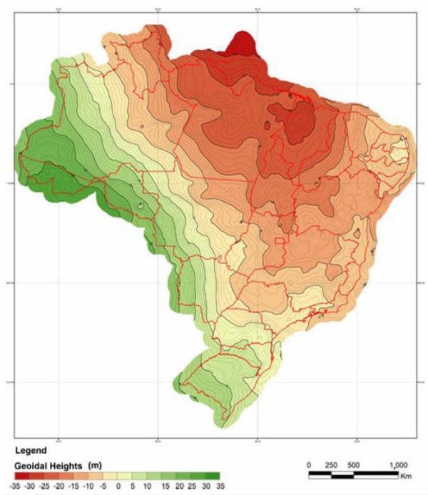
Fig. 2: Isolines of the Brazil Geoid 2012 computed with the DFHRS software version 4.2.
Geodetic Infrastructures for GNSS Positioningservices in BRAZIL 2013
6th German-Brazilian Symposium, Sustainable Development (6. Deutsch-Brasilianisches Symposium Nachhaltige Entwicklung, 6° Simpósio Brasil-Alemanha Desenvolvimente Sustentável), 29.09.2013 - 05.10.2013, Universidade Federal do Oeste do Pará, Santarem, BrasilienPoster-Presentation: Prof. Dr.-Ing. Reiner Jäger: "Geodetic Infrastructures for GNSS Positioning Services (GIPS) - General Concept and GIPS-Development for the State of Brazil"
