DFHRS - Hessen
The computation of the DFHRS Database Hessen, a state in central germany, started in the autumn of 2001
in the frame of a common diploma thesis at the Fachhochschule Frankfurt and the Fachhochschule Karlsruhe.
The project took place on behalf of the state land survey departmentof of Hessen. 72 precise points where made
available by the state department and set up to a commone adjustment with the EGG97 Quasigeoid. In places of
less accuracy new identical points where produced in the frame of the diploma thesis in static as well as
in RTK measurements. So finally a total number of 104 identical points of different a-priori accuracy was
used in the production step.
The whole area was subdivided into 886 meshes (meshsize 6km x 6km) and 10 patches, each with it's own set of
datum parameters.
The results of the quality control again showed, that the 1cm DFHRS standard was reached. The mean of so-called
REPRO values of the identical points was calculated with 1,1 cm. As shown in the concept of the DFHRS quality
control, the variances of the standard Height and the GPS Height are part of the variance of the REPRO values.
So the mean accuracy could be computed by subtracting this values from the Variance of the REPRO values.
The DFHRS concept also includes the possibility to update the Databases, whenever new information e.g. identical
points are available. The state land survey departments can do this on their own, with a DFHRS software license.
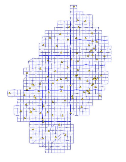
Fig: DFHRS meshing with identical points in Hessen.
